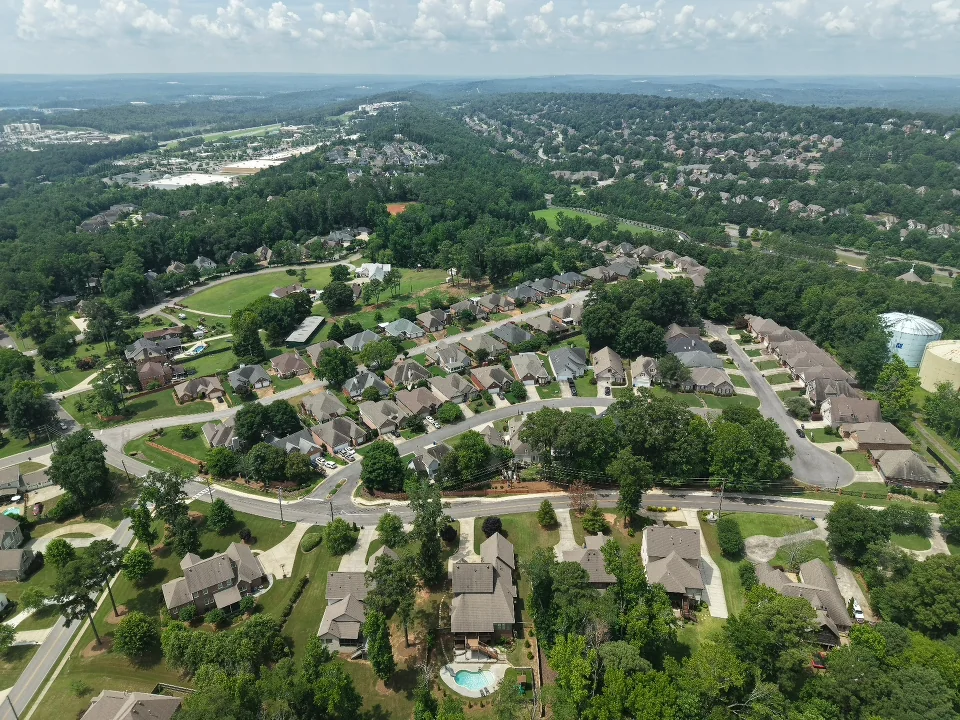
Real estate drone photography
Real estate drone photography and aerial video for listings across the Birmingham, Alabama metro. Show the home, lot, and surrounding setting with aerial stills, video, or both. Coverage depends on the property, weather, and flight restrictions.
Show the property in its surrounding setting.
Aerial photography provides a view of the home, grounds, and nearby setting that an interior shoot cannot show. It can be useful when outdoor space, a waterfront position, or the relationship between buildings is an important part of the listing.
Aerial photos show the home, lot, and surrounding setting in a still image. Aerial video adds motion when the approach, grounds, or wider view matters to the listing. Stills + Aerials, Essentials, and Pro each include aerial photography; aerial video is available separately. The flight and the usable views depend on the address and conditions on the day.
When does drone coverage help a real estate listing?
When buyers need to understand acreage, outdoor space, the setting, or a lot that is hard to read from ground-level photos. Share the property address and the features you want shown so the coverage can be planned around the listing.
Coverage
- Elevated stills of the property and lot
- Context frames showing the surrounding setting
- Roof and grounds coverage where useful
- Optional aerial motion clips for a property film
Planning the shoot
Share the address and the purpose
Describe what the aerial coverage needs to show: the home and grounds, an outdoor feature, or the wider setting. Include access constraints and any areas that should be excluded.
Choose photos, motion, or both
Aerial Photos, Aerial Video, and Aerial Photo + Video have separate rates. Check the package inclusions rather than assuming an aerial-photo package also contains aerial video.
Allow for conditions
Drone availability is checked during planning. Weather, flight restrictions, and property conditions may limit coverage or require a different capture time; a booking alone does not guarantee that a flight can take place.
Preparing the property
- Provide the exact property address and describe the areas you want shown.
- Note access to gates, grounds, or shared areas, and any site restrictions.
- Move vehicles or bins away from key exterior views where practical.
- Include your listing deadline so weather-sensitive coverage can be planned with it in mind.
What you receive
Stills + Aerials, Essentials, and Pro include professional aerial photography. Confirm any required views or image count during planning; the package does not state a fixed aerial-image count.
Aerial media illustrates the property and its setting. It does not establish surveyed boundaries, measure acreage, or replace a roof or structural inspection. Provide verified boundary information if you need that context discussed during planning.
Standard turnaround is 24 to 48 hours from capture day. Include your listing deadline and preferred platforms in the booking notes so we can confirm delivery timing and the file formats you need.
See Curb Snap's workExplore other coverage.
Compare the services and choose the coverage that suits the property and where you plan to use the media.
Ready to book drone services?
Select the property size and media package, review the expected price and reserved window, then book from live availability.